Blog
The Garmins
Here at La Fuga we pride ourselves on our knowledge of the famous cycling roads of the world, of the stats of the mythical climbs around Europe. But as much time as we spend ‘reccying’ our routes, and preparing our rides, there are occasions when no amount of local knowledge can help. It’s at times like these that we bring in the Garmins.
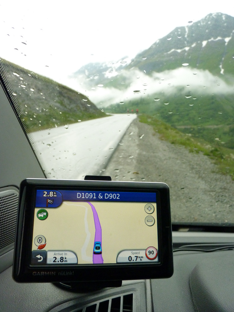
This year Garmin have provided us with several of their GPS navigation tools, for the cars we are blessed with their Live nϋLink! And for the bikes we have the sublime Edge 800, both with full European maps. These help us in a number of different ways from start to finish in the planning, organisation and execution of a successful cycling tour.
We travel all over Europe according to their predicted drive times, we look for nearby hotels and restaurants with them on our extra long transfers, we even check guest flight arrival times using the Live mode whilst still in the car. The possibilities are seemingly endless when it comes to logistics and a Garmin, and logistics are perhaps the biggest part of what we do.
Take one of our Rapha Randonnées for example. These traverse very large swathes of either French or Italian countryside, tackling long epic climbs, but also weaving around the more quaint unknown roads. After deciding on our route we can then take along one of our Garmins and save the trajectory whilst doing the reconnaissance. Once the ‘reccy’ is over we can head back to base, download the files and iron out any mistakes or creases using the very clever mapmyride website.
This gives us exact distances as well as stats such as average gradients, total metres of climbing and detailed route profiles. We can then use these to plan simple things such as lunch stops. Looking at the route profile but also by judging the weather and looking at the forecast, we decide on where we should take our midday snack the next day. If the weather is bad we try to aim for somewhere mid climb so our guests are warm when they arrive and warm up quickly when they leave.
Once the mapmayride files are ready, we then transfer them onto our Garmin Edge 800’s. These very neat pieces of kit have tactile screens for ease of use and so many settings that I’m still quite a long way from discovering them all. As well as coming with heart rate functions and cadence and speed sensors, the Edge 800s are also compatible with your power meter allowing you to use just one display and keep your handlebars uncluttered. Although we go over each route again and again, having the route there in front of you gives you piece of mind as to where you need to go. The live stats they give are seemingly unlimited. Current gradient, temperature, vertical ascension speed, as well as all the regular ones let you know exactly what you are doing and how long you’ve been doing it for. Using the maps on descents is also very useful to warn the guests as to any sharp oncoming corners. A quick look down and a hand signal can make sure nobody comes into a tight hairpin too hot.
Even when we’re just riding for fun from our base in the south of France, we can head out in the knowledge that we’ll always be able to find our way back, no matter how badly we’re on our knees. Getting to airports, finding hotels, planning the next day’s transfers, the garmins are invaluable pieces of kit for us at La Fuga


